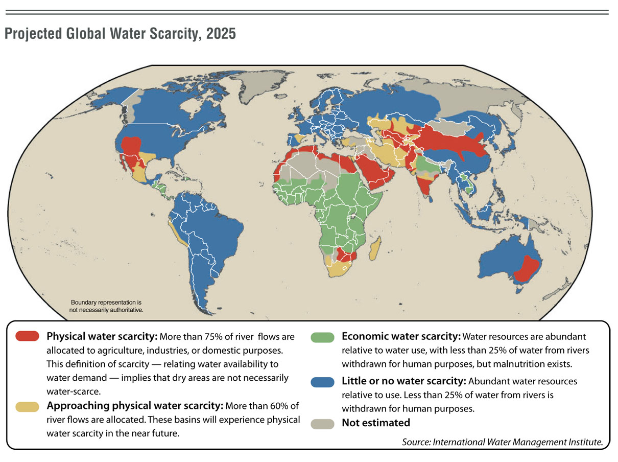
Map 1: Projected Global Water Scarcity, 2025
This world map was located through the link in Week 2: Map Anatomy and is located within the Perry-Castañeda Library Map Collection on the University of Texas' website. This is a thematic map showing what water resources and allocation might be like globally in 2025. The map also gives detailed reasons for why these locations have the projected water issues and what percent of water is being allocated for human purposes. The theme of water scarcity within this map stuck me as extremely relevant. Learning about Los Angeles' water scarcity issues of today worries many people, including myself, about how sustainable it will be tomorrow. This map illustrates other locations, like Los Angeles, that also will be experiencing extreme water scarcity in 2025.
(http://www.lib.utexas.edu/maps/world_maps/water_scarcity_2025.jpg)

Map 2: Landsat Station Fire
I browsed the Landsat Missions section on the USGS site to locate this map of the Station Fire in Los Angeles. This Landsat image has been falsely colored to emphasize the areas of interest. The result is quite stunning. The image shows the areas burned in orange and the areas burning at the time of acqusition in the bright multicolor areas. This picture was taken in the first stages of the Station Fire on August 30, 2009 and in turn only shows a portion of the actual area burned. The quality, coloring, and locality of the image drew me to it. The burnt, stilling burning and smoke filled skys are well emphasized by the quality and coloring of the image.
(http://landsat.usgs.gov/images/gallery/143_L.jpg)
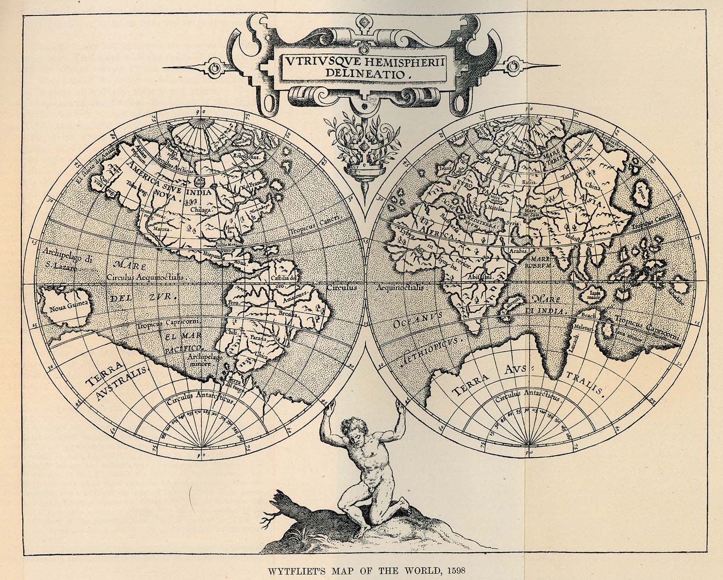 Map 3: Wytfliet's Map of the World, 1598
This map was also located at Perry-Castañeda Library Map Collection on the University of Texas website. This map would be categorized as a historical map and offers a unique view of the world. I would assume the character at the bottom of the map would be the Greek mythological figure of Atlas, whose name became synonymous with collections of maps. This ornamental map of the renaissance abstracts the size of the world's land masses potentially due to the lack of exploration accomplished or lack of accurate methods for approximating size. Historical maps offer great interest due to their beauty and for the lessons they hold for modern cartographers.
(http://www.lib.utexas.edu/maps/historical/wytfliets_world_1598.jpg)